Princely States: a data analysis
Even after 75 years of its demise, the British empire in India has remained a fascinating subject to people at large as well as to a wide range of experts in history, economy, social sciences and many other academic disciplines.
Total Views |

Even after 75 years of its demise, the British empire in India has remained a fascinating subject to people at large as well as to a wide range of experts in history, economy, social sciences and many other academic disciplines.

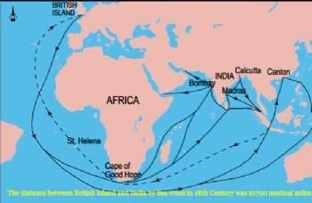
A small country like British Island was able to colonize a huge country like India covering a vast distance between them has always facinated people. It was a turbulent era of this ancient nation. Many aspects of the dramatic changes in India in this period are still being explored and some of them are topics of hot debate.
The existence of some 600 odd Princely States within the empire for more than 100 years and their dramatic merger with independent India within a few years is one such topic with endless intrigue. Many 'royal' families still enjoy a considerable influence in today's electoral politics in their erstwhile ' States' and surrounding region. The royal palaces and affluent lifestyle of some Princes continues to remain a subject of general interest and a juicy subject for novels and movies.
Princely States: a misnomer for a vast majority
The memoranda on Princely States 1935 published by the British Government counts 584 Princely States. Analysis of them on the basis of area, population and annual revenue gives a fair idea about the actual strength of these States.
The figures are quite revealing. 349 States had less than 1 lakh Rs. annual revenue in year 1935. Only 13 States had more than 1 Crore Rs. annual revenue.
Population of Princely States
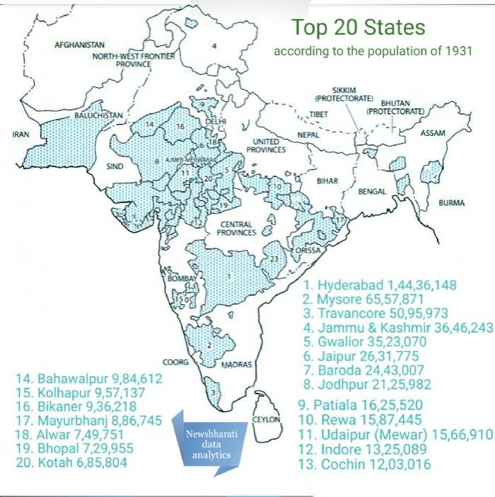
From the area analysis it can be easily guessed that majority of the States had very small population. According to 1931 Census, the total population living in Princely States was 8,00,75824. The share ot the top 20 States according to population was 5,42,89137 while the share of the rest of the 561 States was 2,57,86,687.

The Top Ten
Finally, if we consider all three criteria together, the top ten States in each category are
Geographic distribution of the Princely States
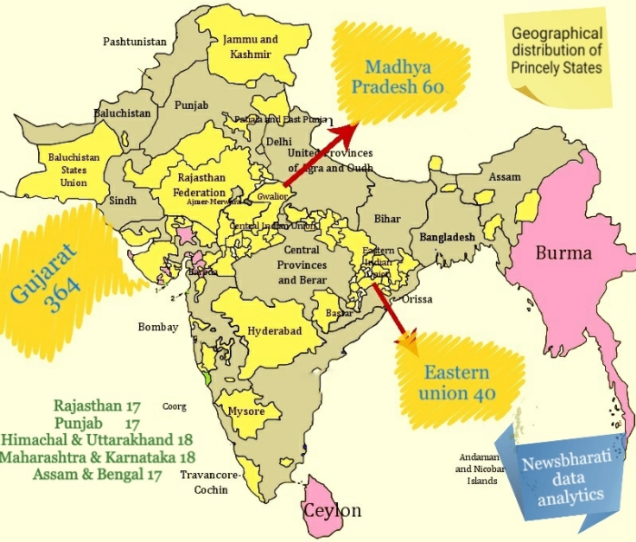
The spread of these States across India is very uneven. If counted according to current Indian States, they exhibit a very peculiar pattern.

All this analysis gives rise to multiple interesting questions. Why such pattern of 'Princely States' developed in British empire, how the empire controlled these States, who were the rulers of these States, How much ' independent' were these States, whether they were beneficial to Indian people or just helping hands of empire, whether people in 'British India' more prosperous than citizens of these States, how after more than 100 years of existence these States merged In independent India in just few years, these and other topics are still being explored by scholars of various disciplines. This series will explore such topics with relevant data and analysis.

